Leonor SurveyingServices home
Relocation Survey

Roadside Relocation Survey in La Castellana

A relocation survey in La Castellana, Negros Occidental, with roadside total-station measurements, prism-pole observations in dense vegetation, and on-site document review.

View project photos
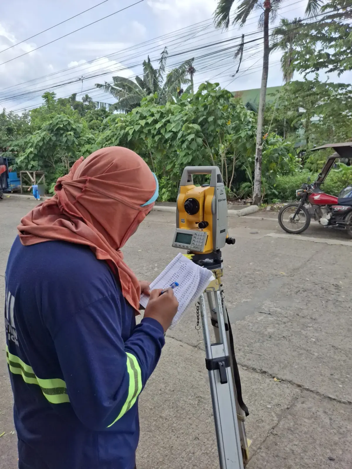
Survey operator recording field notes beside a tripod-mounted total station on a neighborhood street
Recording field observations beside the total station.
On site

The Project Story

Relocating Boundaries beside an Established Street

A relocation survey identifies a property's boundaries on the ground using its title or approved survey plan. It helps owners distinguish the legal lot limits from nearby roads, walls, vegetation, and other visible features.

This project documents relocation survey fieldwork around a heavily vegetated roadside lot in La Castellana, Negros Occidental. The photographs show a tripod-mounted total station on the street and a prism pole positioned both along the curb and inside the vegetation, with observations recorded in a field notebook.

Working between the Roadside and Dense Vegetation

The total station and prism pole work together to measure positions across the site. In this photo record, the operator works beside the instrument while another member of the field crew holds the prism at observation points near the roadside and among banana plants and other ground cover.

Several views show the pole positioned over a red-painted mark at the curb, while others follow the crew into the overgrown lot. The surrounding houses, concrete walls, and passing traffic provide context for the fieldwork; none of these visible features alone establishes a legal property boundary.

Reviewing Documents alongside the Field Observations

The additional photographs show a roadside discussion beside the total station and an on-site review of printed documents using a laptop at a sheltered worktable. Together with the instrument and prism-pole views, they show both the measurement work and the review of available records.

Faces and readable document and screen details are obscured in the published photographs to protect privacy. These images illustrate the work process; they do not publish a client's records or establish a particular boundary result.

Relocation Surveys for La Castellana Property Owners

The service rendered at this La Castellana site was a relocation survey. The photographs document the roadside and vegetated working conditions without claiming a particular lot size or boundary outcome.

For property owners in La Castellana considering a fence, a property purchase, or improvements near a lot line, a relocation survey can help clarify where the property lies. Share your title, available survey plan, and site details with our team so we can discuss the records and fieldwork your property needs.

All projects
From the field

Project Photographs

30 photographs from this project. Select a photograph to view the full image in a new tab.

Survey crew gathered beside a total station on the sidewalk next to a parked white utility vehicle
The crew gathered beside the instrument at the roadside setup.
People discussing the roadside work beside a total station and a densely vegetated lot
Discussing the site beside the total station.
Roadside discussion with one person pointing toward the curb beside the vegetated lot
Discussing a ground position along the curb.
Crew member holding a prism pole upright at a curbside observation point on a neighborhood street
Holding the prism pole at a curbside observation point.
Close view of a total station aimed toward crew members among the vegetation
The total station facing an observation point inside the overgrown lot.
Survey operator recording field notes beside a total station at the edge of a neighborhood street
Recording field notes beside the roadside total station.
Total station and field notebook in the foreground with crew members inside a vegetated lot
The instrument and field notebook ready for observations into the lot.
Tripod-mounted total station beside a field notebook with an observation point beyond the vegetation
A second view of the total-station setup and field notebook.
Two people standing in the shade beside the street during the relocation survey visit
A conversation at the roadside during the site visit.
Another view of two people discussing the work under a roadside tree
Discussing the fieldwork from a shaded roadside position.
Surveyor reviewing printed documents beside a laptop at a sheltered outdoor worktable
Reviewing printed documents and laptop records at the site.
Another view of printed survey documents being reviewed beside a laptop at the worktable
Continuing the on-site document review.
People gathered beside a total station on the sidewalk at the edge of the vegetated property
A roadside discussion beside the instrument and vegetated lot.
White utility vehicle parked beside the crew and total station on the sidewalk
The roadside setup beside the parked utility vehicle.
Two crew members reviewing printed documents with a laptop on a wooden table under a shelter
Reviewing the available documents together at the sheltered worktable.
Surveyor comparing a printed document with laptop records while another person sits across the table
Comparing the printed documents with records on the laptop.
People discussing a curbside ground position beside the neighborhood street
Discussing the ground position at the edge of the street.
Survey operator using a field notebook beside a total station facing the overgrown lot
Recording observations beside the total station.
Survey operator writing in a notebook beside a total station with a prism-pole holder across the street
Recording a roadside observation with the prism position across the street.
Wide view across the street toward a total-station operator working under a tree
The instrument setup viewed from across the neighborhood street.
Field crew member holding a prism pole among banana plants and dense vegetation during a relocation survey
Positioning the prism pole inside the overgrown lot.
Survey prism held upright among thick ground cover beneath banana leaves and palm trees
A closer view of the prism position within the vegetation.
Rear view of a prism-pole holder at a red-painted curb mark with a total station across the street
The curbside prism position and the instrument across the street.
Two people beside a survey prism pole at the edge of a vegetated roadside lot
Checking a prism-pole position near the roadside vegetation.
Field crew facing a total station across a neighborhood street from a roadside prism position
Coordinating field observations across the street.
Prism-pole holder and another person standing beside a wall and dense roadside plants
Fieldwork along the vegetated edge beside neighboring buildings.
Survey operator recording field notes beside a tripod-mounted total station on a neighborhood street
Recording field observations beside the total station.
Prism pole held at the curb along a neighborhood street with nearby shops and passing traffic
A roadside observation point with the surrounding street in view.
Field crew member holding a survey prism upright on a concrete road near neighboring buildings
Holding the prism for an observation on the concrete road.
Survey operator sighting through a total station under a tree with a notebook beside the instrument
Sighting through the total station from a shaded roadside position.
Work With Us

Need a Relocation Survey?

Tell us about your property in La Castellana, Negros Occidental and the documents you have available. We will help you understand the next steps.

Request a survey quote