Leonor SurveyingServices home
Relocation Survey

Relocation Survey in E. B. Magalona

Fieldwork for a relocation survey in E. B. Magalona, Negros Occidental, documenting an existing concrete monument and GNSS observations across rice fields and dense vegetation.

View project photos
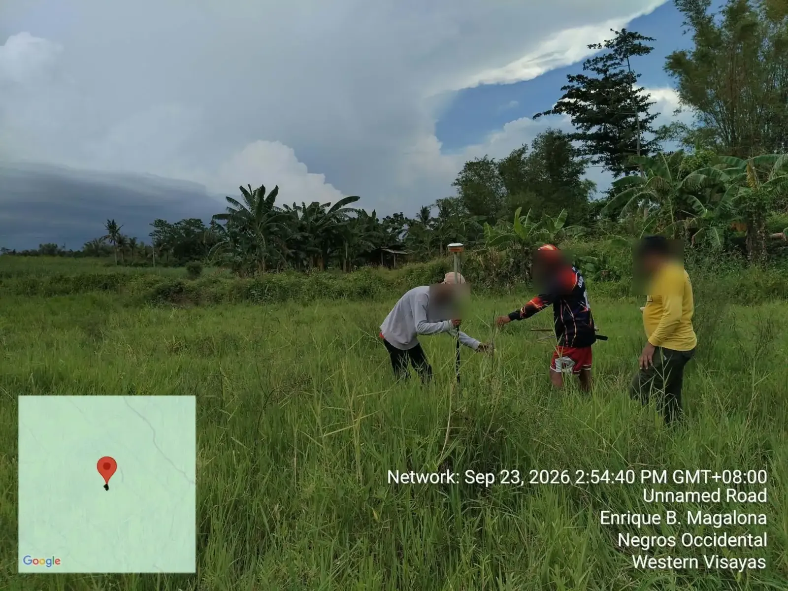
Field crew using a GNSS survey pole in grassland in E. B. Magalona, Negros Occidental
GNSS field observations in open grassland in E. B. Magalona.
On site

The Project Story

Locating Property Boundaries on the Ground

A relocation survey locates a property's boundaries on the ground using its title or approved survey plan. It helps landowners understand where their lot lies before making decisions about fences, improvements, or the use of adjoining land.

This project brought our team to E. B. Magalona, Negros Occidental, for relocation survey fieldwork in an agricultural setting. The photographs follow the work from an existing concrete monument beside a building to grassy areas, rice fields, and densely vegetated ground.

Fieldwork across Rice Fields and Vegetation

The photo record shows a GNSS receiver on a survey pole, a handheld controller, and the crew working at ground level. In several frames, the pole is positioned beside the concrete monument; in others, the crew carries out observations among the crops and along the field embankments.

Tall grass, bamboo, and narrow paths are part of the working conditions shown at this E. B. Magalona site. These views illustrate the hands-on work involved in reaching survey points rather than relying on a fence line or the visible edge of a planted field as proof of a legal boundary.

Planning a Relocation Survey in E. B. Magalona

For property owners in E. B. Magalona and elsewhere in Negros Occidental, a relocation survey is a useful step before placing a fence or planning improvements close to a lot boundary. The title, approved plan, available records, and actual site conditions determine the work needed for each property.

If you need help understanding your property's boundaries, contact our team to discuss your location and available documents. We can explain the next steps for a relocation survey without assuming that a visible marker or a neighboring structure establishes the boundary on its own.

All projects
From the field

Project Photographs

20 photographs from this project. Select a photograph to view the full image in a new tab.

Close view of an existing concrete survey monument beside stones and tree roots in E. B. Magalona
An existing concrete monument photographed during the site visit.
Concrete monument beside a seated person near a building at the E. B. Magalona survey site
The monument and its immediate surroundings beside a building.
A person holding a GNSS receiver and controller beside a concrete monument in E. B. Magalona
A GNSS pole and handheld controller positioned beside the monument.
Field crew working around a survey pole among tall grass during relocation survey fieldwork
Working at ground level among dense, tall vegetation.
Field crew using a GNSS survey pole in grassland in E. B. Magalona, Negros Occidental
GNSS field observations in open grassland in E. B. Magalona.
Survey pole held near bamboo and dense vegetation at the E. B. Magalona project site
Field observations near bamboo and the vegetated edge of the site.
Elevated view of field crew and GNSS pole among rice plants in E. B. Magalona
A view from the embankment of the crew working among rice plants.
Two people positioning survey equipment in a rice field bordered by banana plants
Positioning the survey pole within a rice field.
Crew working in a rice field while another person watches from the raised field edge
Coordinating fieldwork between the rice field and its raised edge.
A person holding a GNSS receiver and controller in a grassy clearing during the relocation survey
Using the GNSS receiver and controller in a grassy clearing.
Survey crew carrying a GNSS pole along a grassy path between cultivated fields in E. B. Magalona
Carrying the GNSS equipment along a path between fields.
GNSS pole holder and another crew member moving through tall grass beside banana plants
Moving between observation points through tall grass and banana plants.
Two crew members carrying a GNSS pole along a narrow rice-field embankment
Following a narrow embankment at the edge of the rice field.
Crew member using a GNSS receiver and handheld controller among thick vegetation
Checking the GNSS controller in dense vegetation.
Three crew members gathered around a GNSS pole in a grassy clearing
Coordinating the pole position and work at ground level.
GNSS pole holder beside a crew member bending toward the ground in tall grass
Working at ground level while keeping the GNSS pole in position.
Three crew members checking the ground beside a GNSS pole in open grassland
Checking a ground position during the relocation survey fieldwork.
Field crew gathered around a GNSS pole on a shaded path bordered by bamboo
Observations along a shaded, densely vegetated path.
Two crew members working beside a GNSS pole among rice plants and banana trees
Reaching a survey position among the rice plants.
GNSS pole holder in a rice field beside a crew member using a controller under an umbrella
Using the handheld controller from the raised edge of the rice field.
Work With Us

Need a Relocation Survey?

Tell us about your property in E.B. Magalona, Negros Occidental and the documents you have available. We will help you understand the next steps.

Request a survey quote